The Operating System for Nature Monitoring

Collect, manage and validate ground and remote monitoring data in one system
s
s
g
u
z
d
d
g
s
r
From fragmented monitoring to structured MRV workflows
As projects scale, monitoring data often becomes harder to manage across sites, teams, and tools. NatureGrid helps teams collect ground data offline, centralize remote monitoring inputs, track validation, and work from cleaner reporting-ready datasets.
e
b
Organised monitoring data
Field data, photos, plot measurements,  files, and remote monitoring outputs often live in different places.
NatureGrid brings them together in one shared system.
e
b
Consistent collection workflows
As more teams and sites are involved, data is often collected in different ways and with uneven quality.
NatureGrid adds structure through configurable templates, standardized submissions, and validation workflows.
e
b
Efficient reporting preparation
Reporting often requires too much chasing, checking, and consolidation before data is usable.
NatureGrid helps teams stay closer to reporting-ready data.
Our technology. Built for real monitoring operations
c
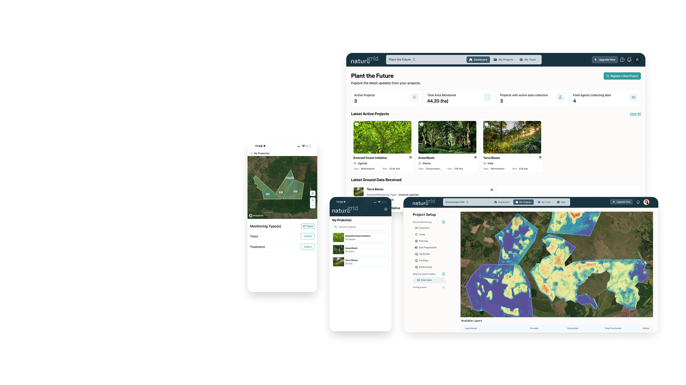
NatureGrid dashboard showing nature project monitoring, field submissions, and reporting data. 
NatureGrid mobile app for offline ground data collection in nature projects.
TECHNOLOGY
NatureGrid's Stack
Dashboard
Centralize submissions, review progress, track validation, and manage field and remote monitoring data in one environment.
Mobile Application
Collect georeferenced observations, photos, measurements, and plot data in the field with offline-ready forms built for remote conditions.
How it works. From field collection to reporting-ready outputs
Coordinate
01
Plan, structure, and manage every nature project from one centralized workspace
Set up project areas, monitoring zones, and sample plots
Build custom ground data collection forms
Assign field agents to specific projects and data collection tasks
Track progress across teams, locations, and active monitoring activities
Arrow right icon
Capture
02
Collect reliable ground and remote sensing data, even in challenging field conditions
Use standardized forms to collect consistent ground-truth data
Enable field teams to work offline in remote project locations
Capture georeferenced observations, photos, measurements, and field evidence
Order and access remote sensing layers to complement field data
Arrow right icon
Integrate & Export
03
Bring ground data and remote monitoring together in one reporting-ready environment
Review structured datasets that are easier to validate and manage
Combine field observations with remote sensing insights in one place
Monitor project performance across sites, teams, and data sources.
Export clean, organized data for reporting, audits, and stakeholder updates.
Arrow right icon
z
z
z
z
i
i
z
z
Bring your monitoring operations into one system.
See how NatureGrid can help your team standardize field collection, centralize remote monitoring data, and improve reporting readiness.